


Pleasant Field Baptist Church, Walker County, Alabama
About
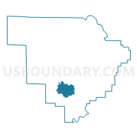
Outline

Summary
| Unique Area Identifier | 523062 |
| Name | Pleasant Field Baptist Church |
| County | Walker County |
| State | Alabama |
| Area (square miles) | 16.89 |
| Land Area (square miles) | 16.56 |
| Water Area (square miles) | 0.33 |
| % of Land Area | 98.03 |
| % of Water Area | 1.97 |
| Latitude of the Internal Point | 33.66817480 |
| Longtitude of the Internal Point | -87.31175020 |
Maps


Graphs
Select a template below for downloading or customizing gragh for Pleasant Field Baptist Church, Walker County, Alabama


Neighbors
Neighoring Voting District (by Name) Neighboring Voting District on the Map
- Liberty Hill Church Voting District, Walker County, AL
- Oakman Senior Citizens Voting District, Walker County, AL
- Parrish HS Old Gym, Walker County, AL
- Tutwiler Fire Dept, Walker County, AL
- Union Hall/Goodsprings Voting District, Walker County, AL